Pinicon Ridge County Park
River and City Loop
My sister Pam met Cash and I for a nice walk through Pinicon Ridge County Park. We started at the “Elk pen” parking area on the west side of the Wapsipinicon River, walked through the park on the west side to join the Wapsi River Nature Trail. We followed this across the river via the the Mary Lundby Bridge through the campgrounds on the east side before connecting with the Central City Trail at Highway 13. We followed this into town to connect with streets and roads to loop back to the original parking lot. We used to camp here often when we were kids, so it was fun to re-visit the area.
Walk-Specific Map
Take Note
- Click on a segment to get specific information.
- Numeric labels correspond to the same labels in the elevation profile and summary information below.
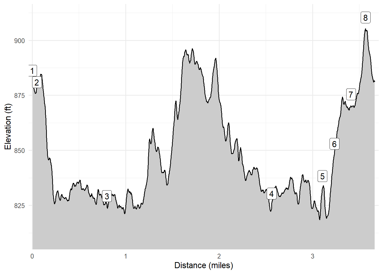
Elevation Profile
Images

IAPNCRDG01: Elk
GPX Download
A sanitized GPX file of our hike is here.
Summary Information
| NUM | trackID | Primary | Description | Type | Distance | CumDist | DeltaElev |
|---|---|---|---|---|---|---|---|
| 1 | IAPNCRDG01 | Horseshoe Falls Rd | Wildlife Viewing parking area to Picnic Area Spur | Paved | 0.05 | 0.05 | -3 |
| 2 | IAPNCRDG03 | Horseshoe Falls Rd | Picnic Area Spur to Wapsi River Nature Tr | Paved | 0.75 | 0.80 | -52 |
| 3 | IAPNCRDG04 | Wapsi River Nature Tr | Horseshoe Falls Rd to Central City Tr | Trail | 1.76 | 2.56 | 1 |
| 4 | IAPNCRDG05 | Central City Tr | Wapsi River Nature Tr to Main St | Trail | 0.54 | 3.11 | 8 |
| 5 | IAPNCRDG06 | Main St | Central City Tr to W Maple St | Paved | 0.13 | 3.23 | 15 |
| 6 | IAPNCRDG07 | W Maple St | Main St to Maine Ridge Rd | Paved | 0.18 | 3.41 | 22 |
| 7 | IAPNCRDG08 | Maine Ridge Rd | W Maple St to Horseshoe Falls Rd | Paved | 0.16 | 3.57 | 35 |
| 8 | IAPNCRDG09 | Horseshoe Falls Rd | Maine Ridge Rd to Wildlife Viewing parking area | Paved | 0.10 | 3.67 | -29 |